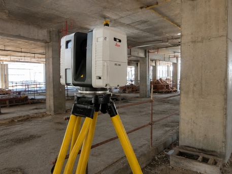
Accurate Existing Conditions Documentation & Asset Digitization
We provide advanced Reality Capture services utilizing Terrestrial Laser Scanning, Mobile Mapping, and Digital Documentation technologies to create highly accurate representations of existing environments.
🎯 Our Services Include:
📌 High-precision terrestrial laser scanning of buildings, industrial facilities, infrastructure, heritage sites, and construction projects.
📌 Mobile Mapping and large-area reality capture for roads, corridors, utilities, and urban developments.
📌 Acquisition, registration, processing, and management of high-density point cloud datasets.
📌 Conversion of point cloud data into accurate As-Built Drawings, CAD models, and BIM models through Scan-to-CAD and Scan-to-BIM workflows.
📌 Existing conditions surveys, dimensional verification, deformation assessments, and progress monitoring.
📌 Digital documentation of heritage assets, industrial plants, refineries, airports, and complex engineering facilities.
📌 Generation of engineering-grade digital records for renovation, expansion, retrofit, and asset management projects.
🟢 To schedule Reality Capture services:
📞 Call or WhatsApp: +966590875436
✉️ Email: [email protected]